
Winter is HERE! There have been a number of interesting observations mentioned by the CAIC in the statewide weather forecasts, including a skier triggered avalanche, and results from control work done by CDOT near Loveland. The regular zonal snowpack bulletins from CAIC haven't started yet, but the active community in our area have reported some very sketchy conditions in the Cameron Pass area. Most interestingly, an ice layer from freezing rain on 28-Oct-2017 all the way to up 11,700 feet (South Diamond Peak Summit)!
Diamond Peaks patrollers and NSOS instructors headed up to the area Sunday 5-Nov-2017 to check this layer out.

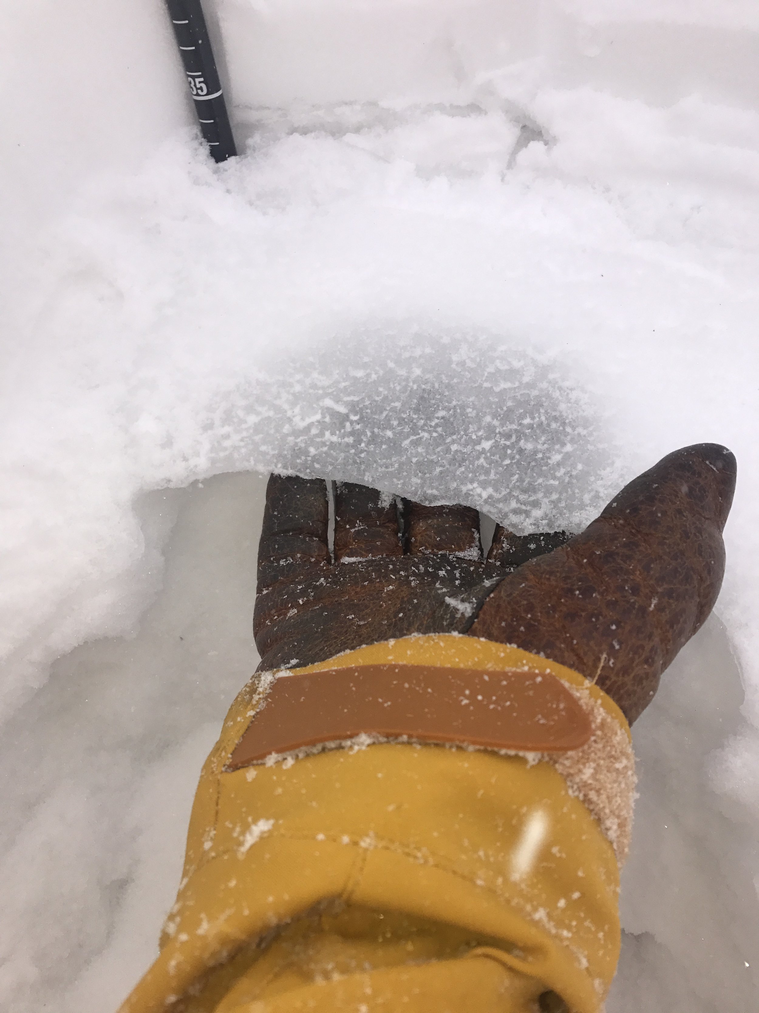
Indeed it is there! It has been snowing up high since Friday 3-Nov, so it required some light digging through 30ish cm of fantastic snow, but we found an incredibly stout 3mm ice crust 34cm up from the ground in a 75cm snowpack near the top of the Montgomery Bowls. Facet formation was observed BELOW and ABOVE this lens (as you would expect), and forecasters suspected that this layer could cause some interesting activity in the weeks, possibly months, to come.
Is this layer strong enough to "raise the ground level" and reset the snowpack? Or is it just strong enough to create a slab on top of growing facets? What happens as it starts to break down? Uncertainty like this is a great reason to give more time after storms, more distance from steep slopes, and more room for error in your trip plans. Keep this in mind for future decisions, and play safe!!